For hundreds of years, there have been countless efforts, endeavors and attempts to resettle Jews in Palestine. These isolated and disjointed attempts however, proved unfruitful due to being disconnected and scattered, up until the Palestine Exploration Fund (PEF) was established to explore Palestine. The move marked the first serious and organized step to achieve this common goal.
So what is the story of this fund?
On May 12th, 1865, a meeting was held in the Jerusalem Chamber in London’s Westminister Abbey. The gathering was headed by Archbishop of York William Thompson and attended by those interested in the organization’s proposed items, according to an ad published in London’s The Times. In her paper “Activities Of The Palestine Exploration Fund (1865-1915)”, Khairiya Qasimiya mentions that all those attending were either senior and leading clergymen, members of parliament, or lords and dukes.
During the meeting, a decision was made to form an association under the name “Palestine Exploration Fund”, dedicated to studying the archaeology, geography, geology, and natural history of Palestine. They also announced that it will be founded under the royal patronage of Queen Victoria herself, who donated a sum of 150 Pounds Sterling.
Qasimiya states that Oxford University contributed 500 pounds to the fund, while both Cambridge and the Committee For the Enhancement of Syria allocated 250 pounds each. The United Grand Lodge of England donated 150 pounds, alongside numerous other organizations and individuals.
Preliminary Measures
The creation of the fund was not an idea that spawned overnight; certain events and proceedings paved the way to its creation, such as the founding of the Palestine Association in 1804, which sought to gather info on the Holy Land in a move to establish British control over Palestine and protect main trade routes between Britain and India, as Professor of Modern & Contemporary History Dr. Hamada Naji tells Raseef22.
According to Naji, this association does not have any listed efforts except the translation and publication of the book “Travel Through Palestine, Phoenicia, Jordan, & Lower Egypt” by German explorer Ulric Casper Sitzen after visiting Palestine and its surrounding regions.
In 1830, the Royal Geographical Society was formed, but Naji says its activities were globally focused and did not focus enough attention on Palestine.
By 1838, British policies towards Palestine had crystallized further, especially following concerns of Muhammad Ali Pasha seeking to establish a greater Arab nation. In consequence, a consulate was established in Jerusalem, appointing itself as a protector of Jewish groups there. Naji states that this came at a time voices were calling for the necessity to resettle Jews in Palestine in order to insure the security of main trade routes to India.
This change set forth an influx of adventurers, travelers, officers and engineers from both Britain and other nations alike to explore Palestine. Among them was American biblical scholar Edward Robinson in 1838, lieutenant R.A. Simonds of the Royal British forces in 1841, lieutenant Charles William Meredith Van De Velde of the Dutch Royal Navy in 1851, as well as English priest Arthur Stanley in the years of 1856 and 1862.
Delivering Water To Jerusalem
Doctor Khairiya Qasimiya states that the main driver that contributed to the fund’s creation happened in 1864. During a time that saw increasing interest in Palestine, Baroness Burdett-Coutts (also known as Angela Georgina) decided to donate 500 Pounds Sterling to supply Jerusalem with water, as part of voluntary and charity work she undertakes to care for the poor and improve their standards of living. The first step to achieve this goal consisted of the British military drawing maps of the city and surrounding areas.
Countless efforts and attempts have been made over the centuries to resettle Jews in #Palestine, however they were individual and disjointed, up until the Palestine Exploration Fund was established. So what is the story of this fund
Qasimiya recounts how British officer Charles Wilson was chosen along with a team from the Corps of Royal Engineers to conduct a sweep of the area. In consequence, a detailed blueprint of Jerusalem was drawn, including layouts of significant landmarks in the city such as the Dome of the Rock and Church of the Holy Sepulcher among others. A sweep was conducted on the region surrounding Jerusalem as well.
The British land sweep and survey agency then published reports, blueprints, and images along with comprehensive notes and observations including important information about the region.
Wilson’s work held great value to those interested in Jerusalem’s history and marked the cornerstone of the scientific exploration of Palestine; it also represented a motive to form the Palestine Exploration Fund.
The Founding Statement
According to Qasimiya, the organization held a meeting in Porthminster on July 22nd, 1865 to announce its official establishment and author a founding statement in which the organization’s objectives were clarified. The organization reiterated the importance of a central Palestine when it came to religious ideology and the dire need for a clearer interpretation of ambiguous texts in the Torah. It also stipulated the importance of distinguishing the country’s topography, climate, produce, customs, cultural products, and lifestyles. The statement articulated that without deeper understanding of the country, the religious texts relevant to the region will remain obscure.
The organization also stated that a detailed topographical map of the country could be drawn, in order to explore the locations of buried archeological ruins and compile what was already discovered separately in a more categorical framework. In addition, the organization suggested dispatching a multi-disciplinary mission to compile a comprehensive report on Palestine. The expedition would be granted enough time and significant funding, as well as facilitated with all possible accommodations so that it can reach a formal account approved in mass consensus.
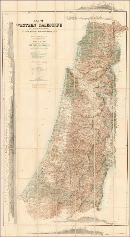
Moreover, in his book ‘The Invention of Ancient Israel: The Silencing of Palestinian History’, British scholar Keith Whitlam mentions that the fund sanctioned a geographical scan of 6,000-square-miles of Palestine between the years 1871 and 1875. The scan yielded 26 exhaustive maps of the area, all with detailed precision that indexed up to 46 categories from city, village, vicinity, to well, shrine, hilltop, stream, castle, etc.
Ten complete volumes containing botanical, zoological, topographic, and geological data were also published with the maps, along with notes detailing the historical meaning and value of Palestine’s villages.
The Fund & Britain’s Policy
The fund expressed that a major part of its activities spawned from British political ambitions and aspirations in the region. This is something Dr. Ass'ad Razzouk confirmed in his book ‘Greater Israel: A Study in Zionist Expansionist Thought’ when he said, “Those who carried out the excavations and discoveries were military personnel, specifically the Corps of Royal Engineers, and most of them moved between Cyprus, Syria, Palestine, Egypt, and Sudan, working in fields of activity that go beyond the adoption of scientific principles when it comes to discovering the landmarks of the Holy Land.”
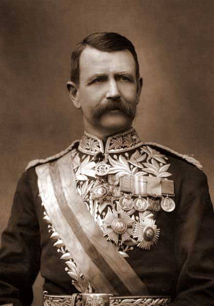
Sir Charles Wilson was among the first to volunteer in 1864 to begin the operation of sweeping Jerusalem and its suburbs while connecting water to the city. The report he submitted with his letters was the Palestine Exploration Fund’s first publication in 1866. He went on to later sweep the Al-Khalil (or Hebron) region as well. However, according to Razzouk’s account, he later on signed up to co-lead a military campaign sent in 1885 to rescue Major-General Charles George Gordon, the British Governor of Sudan, during the Mahdist revolution.
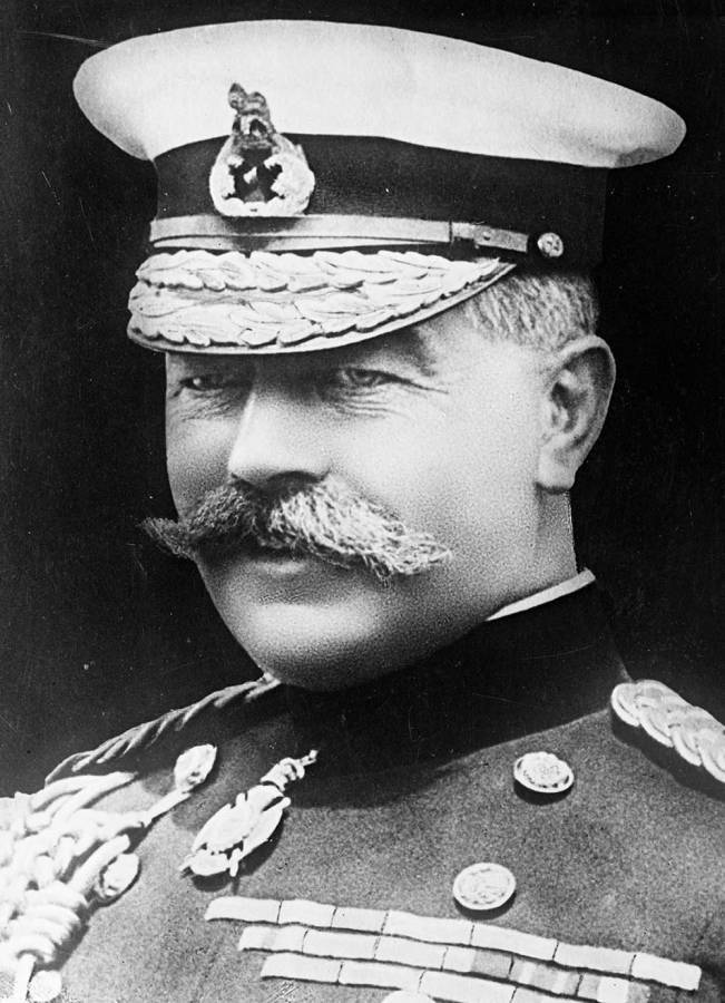
Meanwhile, Marshal Horatio Herbert Kitchener joined the exploration teams in the fall of 1874, conducting sweeps in east Palestine. Razzouk recounts how he was later appointed governor of the British colonies in the Red Sea region in 1886, then leader of the armed forces in the Egyptian army in 1892, to finally become the Acting Governor General of Sudan in 1899.
British Ambitions & Zionist Intentions
According to Dr. Hussam Abu Naser, head of the Bait al-Maqdis Institute for Palestinian Research & Studies, both the work and nature of the fund created areas where British ambitions intersected with the desire of Jews to create their own state in Palestine.
Naser tells Raseef22 that the fund’s main goal manifested in the geographical sweeping of historical and archaeological regions so that the Torahic vision could be dropped on any discoverer as a means to establish the Jewish right to resettle in Palestine.
Qasimiya says that British sympathies with Jews and Jewish settlement projects in Palestine were a part of Britain’s policies in the East, especially since its resistance to Muhammad Ali ruling Syria and Egypt together. The activities of the Palestine Exploration Fund confirmed this convenient connection during the second half of the nineteenth century, as the fund’s committee meetings often referred to the idea of the “return of Jews” on a regular basis. Its work was also responsible for indirectly encouraging the resettlement process by providing a detailed portrayal of Palestine.
Captain Charles Warren (later General and Sir) accompanied the Corps of Royal Engineers into the region, and in 1875 published a book titled ‘The Land of Promise’ where he called for the necessity of the development of Palestine by the "East India Company", aiming at bringing Jews into the country in order to occupy and rule its land, Razzouk says.
Moserian Jews rejected the idea of a homeland in Palestine and considered the land unsuitable for agriculture; But in 1864, a British funded water supply system and the mapping of Jerusalem supported by "Palestine Exploration Fund" studies argued otherwise
Warren justified this with the statement, “Palestine’s inhabitants belong to a mixed race, some of them come from Canaanites, some from Jews, while others belong to the Arabian Peninsula. Therefore we cannot consider the people of Palestine to be pure Muslims of one race, we should instead view them as the descendants of the Canaanites, ancient Israelites, Greeks, Romans, Arabs, and the Crusaders. They may now practice the Islamic or Christian religion, but before anything else they preserve old tradition, and in some cases, they really are preserving their old religion."
Warren did not fail to point out that the new government that will rule Palestine following Jewish occupation will work on increasing the volume of trade exchange, which will in turn lead to multiplying the populace tens of times. He even confirmed the presence of enough land to settle 15 million inhabitants, and that land productivity will increase as the rate of work in land and agriculture does, according to Razzouk.
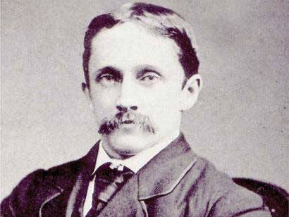
Meanwhile Colonel Claude Conder set out to draw up detailed maps of the region west of Palestine in an attempt to locate the names of areas mentioned in the Bible. He also tracked down the remains and ruins of invading armies and ancient migrations, as well as interpreted and deciphered remaining symbols and inscriptions.
Razzouk claims that Conder’s writings in particular held a great amount of information over excavations he had unearthed from the depths of history. In 1879 he published his book ‘Judas Maccabæus, and the Jewish War of Independence’, as well as ‘Heth and Moab’, ‘Entrance Into Geography of the Bible’, ‘Syrian Stone-lore’ in 1886, and ‘Altaic Hieroglyphs and Hittite Inscriptions’.
Tangible Outcomes
In his book, Razzouk argues that the fund’s activities and publications contributed largely to furthering the Zionist agenda and encouraging its advocates to claim an expanded vision of Palestine. If it wasn’t for the data and studies compiled by the fund, Razzouk suggests that the ‘Promised Land’ would have been little more than an unknown barren wasteland for most Zionists.
Furthermore, Razzouk states, “Moserian Jews rejected the notion of Palestine and considered it uninhabitable and not suitable for mass agriculture or investment. The dominant perception of it in public and in private likened it more to a barren wasteland than to anything else.”
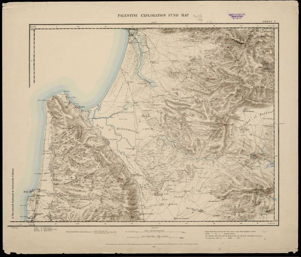
But in 1890, the fund proceeded to place a new version of the map of Palestine at their disposal. It included all incoming information from digging sites and land survey work, extending from Baalbek in the north to Kadesh Barnea - the biblical name for a holy Jewish region that some believe is now the Ain Kadees region - in the south.
The fund also published two prints of the same map, placing only the most recent names on one, while adding to the second version the names of both the Old and New Testaments as well as the names of the places mentioned in the apocrypha (biblical genesis books attributed to the Old Testament but are of dubious validity), along with what Romano-Jewish historian Flavius Josephus listed names that could be identified and recognized.
Abu Naser sees that the fund achieved significant results when it came to the level of research in some natural and geographic fields, and deposited a part of the maps in the then British colonial ministry.
Naji mentions that the British forces used these maps for their movements in the region during the first World War, specifically during the British campaign on Palestine in 1918.
By 1892, the fund’s work was accomplishing more and more on the ground in favor of Jewish settlement In Palestine, as expressed in the book ‘The City and the Land’ issued by the fund. The book included a series of studies and publications, most important of which was the "Future of Palestine" by Claude Conder, according to what Dr. Amin Abdullah Mahmoud mentions in his book ‘Jewish Settlement Projects: From the Beginning of the French Revolution Until the End of World War I’.
Conder indicated that, “The numbers of Jews in Jerusalem in 1793 did not surpass a few hundreds, but now (1892) it has reached 40,000, and they now control trade in the city. Jews are no longer an oppressed and cowardly minority, instead they seem to be the masters of the city now.”
World War I
Up until the end of the nineteenth century, the Palestine Exploration Fund remained the sole foreign body working in the field of archaeological digging and exploration, until, according to Qasimiya, other countries entered the field in friendly competition.
In the early twentieth century, the fund continued its activities but discontinued in the run-up to the first World War (1914-1918), and it was impossible to continue excavations while the war was raging.
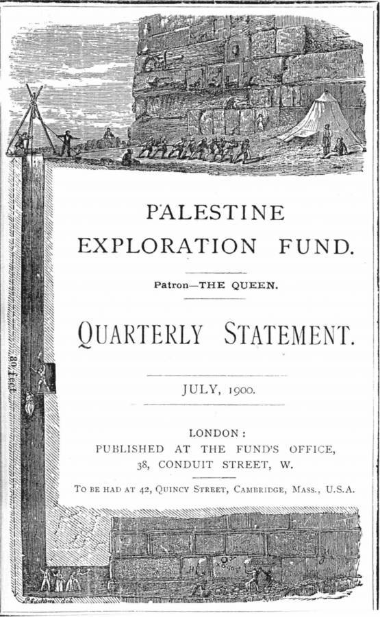
Despite this, the fund’s quarterly statement titled ‘Palestine Exploration Fund: Studying Archeology, Topography, Geology, Natural Geography, Customs and Traditions in the Holy Land’ did not stop, publishing material that had already been prepared before the war.
After the end of the war, the fund returned to its usual activities in Palestine, working in cooperation with the British School of Archeology in Jerusalem, as Qasimiya details.
The fund's services did not just end at the establishment of a state for Jews in Palestine. Ibrahim Abdel-Karim says in his book ‘Orientalism and Conflict Research in Israel’ that following the rise of the state of Israel, the Israeli army benefited in 1948 and 1956 from the old roads that had become forgotten over the years, the same roads that the fund had discovered during the height of its activity and placed on its maps.
To this day, the Exploration Fund still stands within the walls of its old headquarters in London, and its magazine still publishes under the same name, albeit on a semi-annual basis.
Raseef22 is a not for profit entity. Our focus is on quality journalism. Every contribution to the NasRaseef membership goes directly towards journalism production. We stand independent, not accepting corporate sponsorships, sponsored content or political funding.
Support our mission to keep Raseef22 available to all readers by clicking here!
Interested in writing with us? Check our pitch process here!